Welcome to GeoCloud
Create maps, apps and dashboards in seconds with a cloud GIS platform for everyone in your organization.
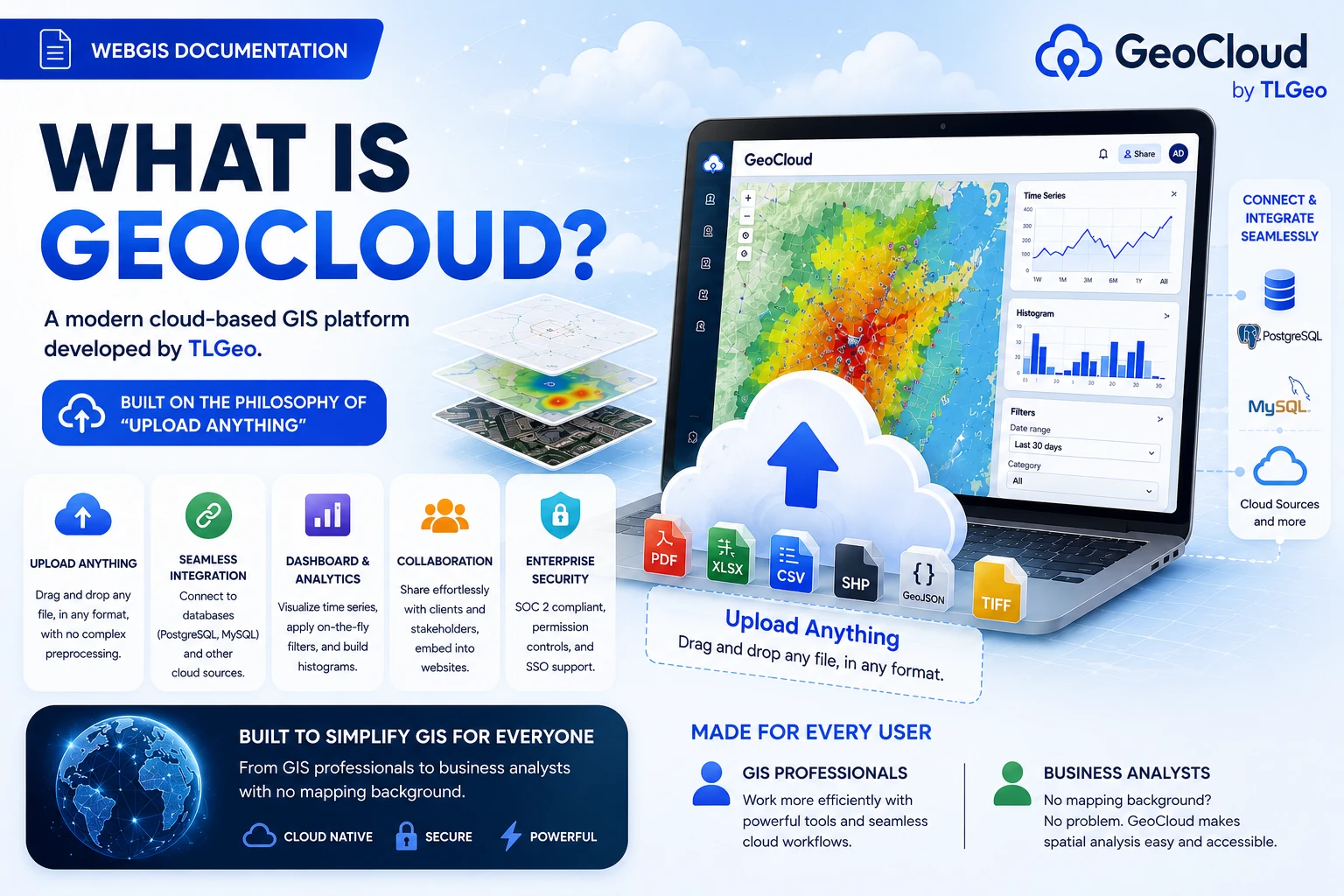
What is GeoCloud?
GeoCloud is a modern cloud-based Geographic Information System (GIS) platform developed by TLGeo. With the “Upload Anything” philosophy, GeoCloud allows you to:
- 📁 Upload Anything - Drag and drop any file, any format, no complex data processing required
- 🔗 Seamless Integration - Connect databases (PostgreSQL, MySQL) and other cloud sources
- 📊 Dashboard & Analytics - Time series visualization, on-the-fly filtering, histogram building
- 👥 Collaboration - Share without configuration with clients, stakeholders, embed on websites
- 🔐 Enterprise Security - SOC 2 compliance, permission controls, SSO support
“Spatial superpowers, made surprisingly easy. Powerful transformations let you highlight spatial patterns and relationships in your data.” — GeoCloud Design Philosophy
GeoCloud is designed to simplify GIS for everyone - from professional GIS technicians to business analysts without a mapping background.
Features Overview
1. Powerful Organization & Project Management
- Create and manage organizations with detailed permissions
- Manage projects by type (COLLECT, PORTAL, BLOG, SHOP)
- Comprehensive role-based access control (RBAC) system
2. Automatic GIS Data Processing
- Upload and automatically process common GIS formats
- Support for vector data (Shapefile, GeoJSON, KML) and raster data (GeoTIFF)
- Processing pipeline with GDAL/OGR integration
3. Interactive Map Interface
- MapLibre GL engine for high performance
- Multiple basemaps from MapTiler and OpenStreetMap
- Drawing tools and spatial analysis
- Map comparison and 3D visualization
4. Collaboration & Sharing
- Real-time collaboration with team members
- Flexible sharing options (PUBLIC, AUTHENTICATED, PRIVATE)
- Comment system and project notifications
- Export in multiple formats
5. Mobile-Friendly & Offline Support
- Responsive design for all devices
- Progressive Web App (PWA) capabilities
- Offline data sync from Geocollect mobile app
Position in TLGeo Ecosystem
[Geocollect Mobile] → [Geocloud Web] → [Geoadmin Backend]
     ↓                      ↓                ↓
Field Data Collection Manage & Process Admin & Config- Geocollect: Collect data on mobile/tablet
- Geocloud: Manage, process and visualize data
- Geoadmin: System configuration and overall administration
Target Users
GeoCloud serves various user groups:
- Survey Teams: Surveying and measurement companies
- Government Agencies: Government and local authorities
- Environmental Organizations: Environmental and conservation businesses
- Urban Planners: Urban planning professionals
- Researchers: Researchers and academics
Explore More
- Basic Tutorial: Get started with GeoCloud in 15 minutes
- Advanced Tutorial: In-depth guides and detailed configuration
- Troubleshooting: Fix common issues
Getting Started
👉 Basic Tutorial - Start with login and interface overview
👉 Create Your First Organization - Set up your organization and invite members
👉 Upload GIS Data - Process your first geographic data